A Spatio-Temporal Approach to Integrated Modelling of Shipping Traffic Impacts on Musqueam Fisheries

Project Details
Location: |
Musqueam Territory; 49.22997, -123.20123 | |
Client: |
Musqueam Indian Band (xʷməθkʷəy̓əm) | |
Duration: |
2018 – 2021 | |
Team Member(s): |
Marc Nelitz, Hugh Stimson, Don Robinson, Caitlin Semmens | |
Practice Area(s): |
Cumulative Effects Assessment | |
Services Employed: |
GIS Analysis, Risk & Vulnerability Assessment |
The Problem We Aimed to Solve
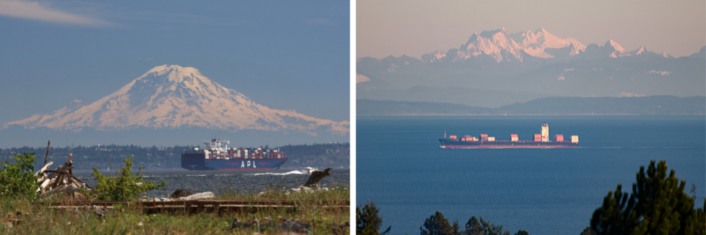
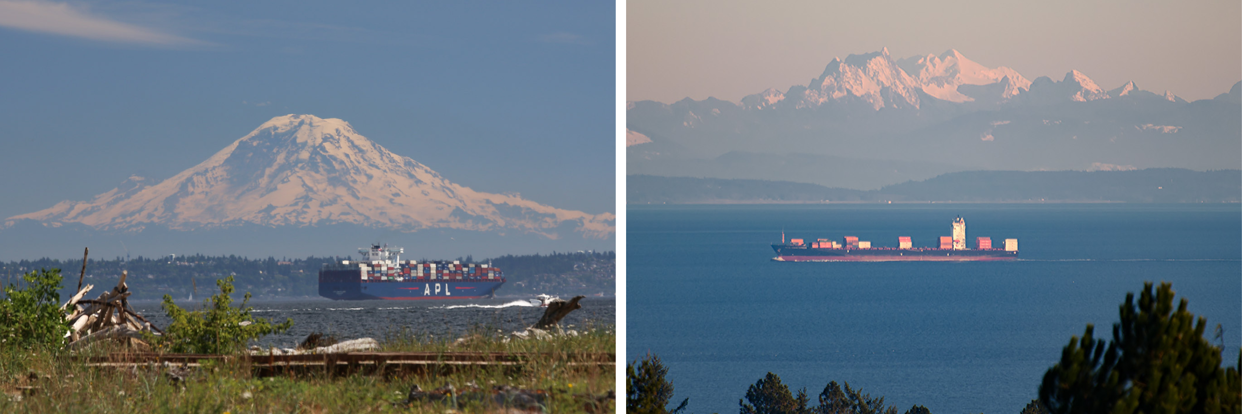
The waters of the Musqueam’s territory are some of the busiest, most used, and most industrially developed in British Columbia. Historic and existing activities have resulted in an alienation of the Musqueam people from fishing opportunities in their ancestral waters. New, large-scale industrial activities and facilities are proposed for the Fraser River estuary which have the potential to further restrict fishing opportunities. If developed, these facilities will result in increased industrial shipping traffic in the waters of the traditional territory of the Musqueam Indian Band, You can learn more about Musqueam place names at the Musqueam Place Names Map.
How We Helped
ESSA was retained by Musqueam Indian Band to assess the contributing factors and cumulative effect of marine vessel traffic on the ability of Musqueam fishers to navigate on and access fishing opportunities within their territory, estimating the potential future impacts of marine vessel traffic on fishing access, and providing broad recommendations on how restrictions in access to fishing opportunities can be minimized. ESSA quantified impacts by integrating spatio-temporal marine traffic data provided by the Department of Fisheries and Oceans (DFO) with Musqueam fisheries opening times, locations, known areas of exclusion, and effort, measured in vessel-hours. Our work provided Musqueam with detailed information on current traffic-related fishing pressures, projected impacts of proposed future industrial developments, and modeled changes to traffic regimes can serve to.
 Our Project’s Impacts
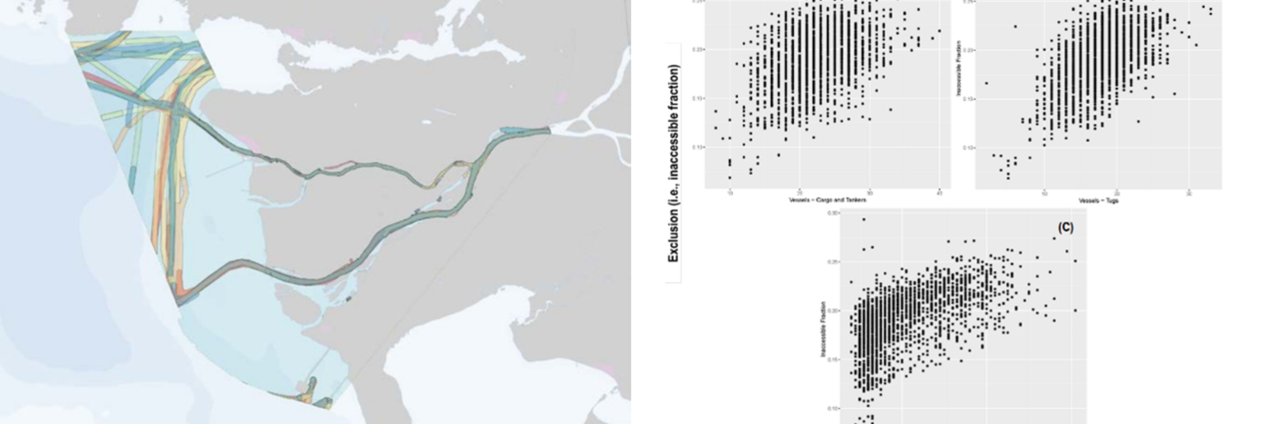
ESSA’s quantitative analysis considers the confounding effects of past, current, and proposed future development activities along the Lower Fraser River and coastal marine areas that may exacerbate the already deteriorating productivity of Musqueam fisheries. The analysis utilizes oral histories of changes to fishing productivity since the 1950’s in light of changes to marine and freshwater resource (salmon, crab, and prawn) status and productivity. The report was entered into written evidence as part of the Trans Mountain Pipeline ULC Application to the National Energy Board (Hearing Order MH-052-2018, File Number: OF-Fac-Oil-T260-2013-03 59).
- The project is archived by the National Energy Board and can be read in full here: https://docs2.cer-rec.gc.ca/ll-eng/llisapi.dll?func=ll&objId=3718340&objaction=download&viewType=1
- The application archive is here: https://apps.cer-rec.gc.ca/REGDOCS/Item/View/3718339