ESSA_logo_MediumESSA_logo_MediumESSA_logo_MediumESSA_logo_Medium
  • Home
  • Approach
    • Our Approach
    • Adapt Card Game
  • Explore ESSA
    • Practice Areas
    • Services
    • Tools
    • Projects
  • News & Insights
    • News
    • Insights
  • Our Clients
  • About
    • Our Story
    • Our Team
    • Where We Work
    • Careers
  • Contact Us
✕

Landscape Fire and Resource Management Planning Tools Project (LANDFIRE)

December 3, 2004

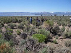
LANDFIRE is National interagency project in the US producing consistent and comprehensive maps and data describing vegetation, wildland fuel, and fire regimes across the United States. As part of LANDFIRE, VDDT is used for modeling the historic range of variability in fire regimes for the entire US. More recently it is also being used to develop future scenarios for alternative fire management activities and ecosystem restoration.

logo

Practice Areas

Adaptive Management
Climate Change Adaptation
Environmental & CEA
Fisheries & Aquatic Sciences
International Development

Services

Facilitation & Engagement
Science Communication
Ecological Modelling
Decision-Support Systems
Monitoring, Design & Evaluation

See Complete Services List

Tools

Jagger’s Law & Turn Taking Optimization
Okanagan Fish Water Management Tool
The Fire & Fuel Effects Model for Forest Planning
El salvador Infrastructure Risk Analysis Framework
Watershed Report Cards

See Complete Tools List

Copyright 2021 ESSA Technologies Ltd | All Rights Reserved
All images are used by permission for photos taken by staff or are licensed under Creative Commons by 2.0